Tuesday, November 8, 2016

ArcMAP : Pythagoras & Trigonometry for Point Movement

 
This posting is talking about how to move one or many point from current position to the new position. This method can be done in ArcMap or Excel, but on this time i will share how to do that using ArcMAP (ArcInfo License).

Monday, November 7, 2016

Creating Contour Map Using SRTM and QGIS


by : Bayu Yanuargi


Contour map is a map that contain the lines which are connected the location with a same elevation. Ussually the elevation are based on sea level but not must, some work not using sea level as a benchmark they prefered to use local benchmark point to get more detils calculation. On this posting we will talking about how to create a contour map using SRTM data that provided by free and for the GIS software, we will using QGIS that's free as well.

Sunday, October 30, 2016

About GIS


A geographic information system (GIS) is a computer system for capturing, storing, checking, and displaying data related to positions on Earth’s surface. GIS can show many different kinds of data on one map. This enables people to more easily see, analyze, and understand patterns and relationships. 

Flood Management Maps Future


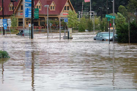
Most flood maps today are not maps of real-life floods; they are maps of an imaginary flood used to help communities get an idea of where especially flood prone areas probably are. Sometimes these are called "100-year flood maps," although that phrase is a little misleading because it is based on statistical probabilities for some specific location, not for a region. There's a good chance that a "100-year flood" will occur somewhere in your state every year.

GIS For Healthy


Geographic information systems (GISs) and geographic information science (GIScience) combine computer-mapping capabilities with additional database management and data analysis tools. Commercial GIS systems are very powerful and have touched many applications and industries, including environmental science, urban planning, agricultural applications, and others.

Work with LIDAR


Lidar (also called LIDAR, LiDAR, and LADAR) is a surveying method that measures distance to a target by illuminating that target with a laser light. The name lidar, sometimes considered an acronym of Light Detection And Ranging, (sometimes Light Imaging, Detection, And Ranging), was originally a portmanteau of light and radar. Lidar is popularly used to make high-resolution maps, with applications in geodesy, geomatics, archaeology, geography, geology, geomorphology, seismology, forestry, atmospheric physics, laser guidance, airborne laser swath mapping (ALSM), and laser altimetry. Lidar sometimes is called laser scanning and 3D scanning, with terrestrial, airborne, and mobile applications.

Satellite Imagery Usage For Mining Exploration


A geographics information system (GIS) is a computer system for capturing, storing, checking, and displaying data related to positions on Earth’s surface. GIS can show many different kinds of data on one map. This enables people to more easily see, analyze, and understand patterns and relationships. 

With GIS technology, people can compare the locations of different things in order to discover how they relate to each other. For example, using GIS, the same map could include sites that produce pollution, such as gas stations, and sites that are sensitive to pollution, such as wetlands. Such a map would help people determine which wetlands are most at risk.


Satellite Remote Sensing has been a standard first step for the mineral and petroleum exploration industry. Satellite imagery from satellite sensors such as GeoEye-1, WorldView-2, QuickBird, IKONOS, ASTER and LANDSAT 7 +ETM have benefited geologists, scientists and exploration managers in earth sciences due to the advantage of large scale mapping and the sensors containing multiple band colors which allows them to interpret wavelengths that cannot be seen by the human eye, such as near infrared, short wave infrared and thermal infrared to identify the difference in structural features of the earth’s surface.